GEBCOSmallScale (Map Service)
View In: ArcGIS JavaScript ArcGIS.com WMTS
Current Version: 10.81
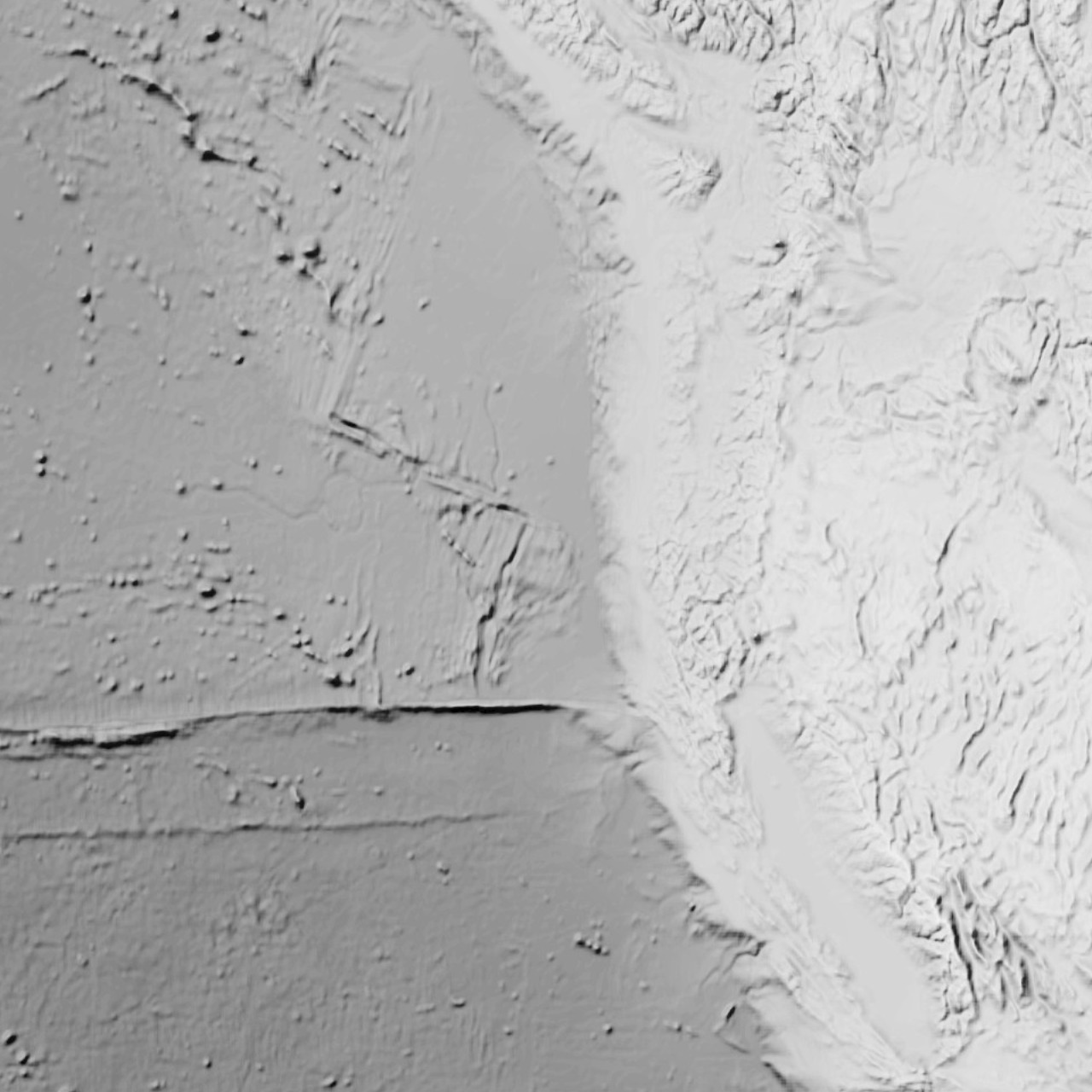
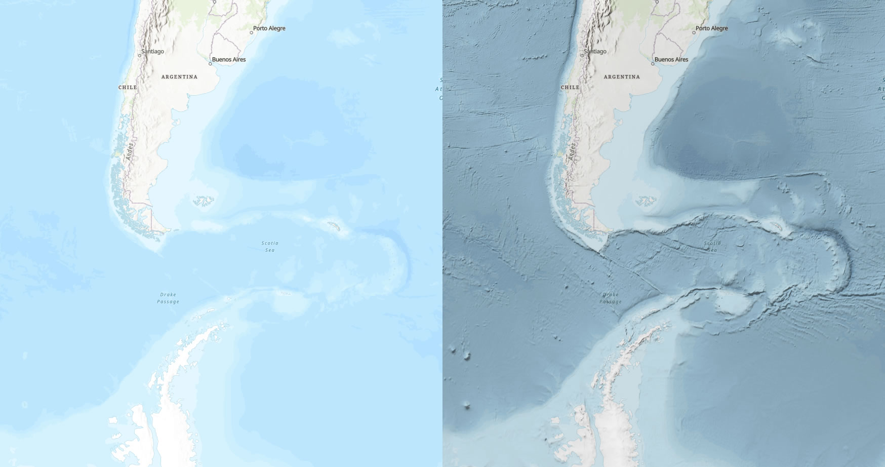
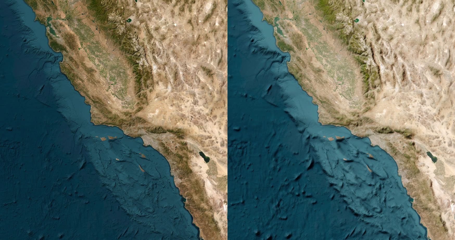
Service Description: Topographic hillshade can provide important context for your map. This Generalized Terrain & Bathymetry tiled hillshade layer is intended to provide a smooth global/regional sense of the terrain and bathymetry, like the manually airbrushed styles of cartographers from decades past.
If you'd like a crisp detailed terrain hillshade, consider World Hillshade tiles. Generalized Terrain & Bathymetry works well in addition to that finer-grained World Hillshade.
This tile layer was derived from GEBCO (General Bathymetric Chart of the Oceans) elevations, and processed as hillshade of generalized scales in ArcGIS Pro in a manner similar to what is described in this how-to video: https://youtu.be/-sitCuwXAaE
For a high-resolution compliment suitable at large scales (zoomed in) consider this GEBCO Shaded Relief 2022 tile layer. Find more GEBCO products in Living Atlas.
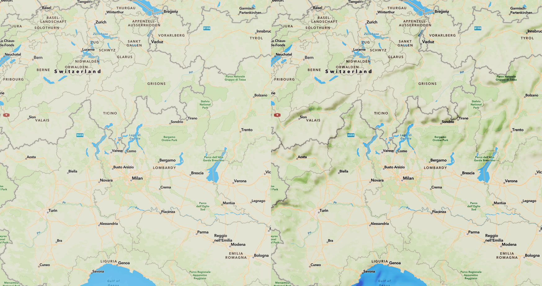
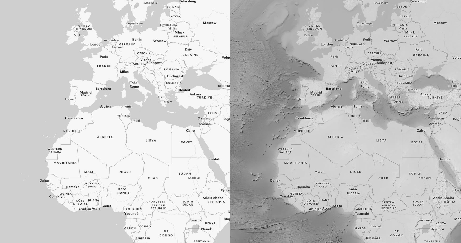
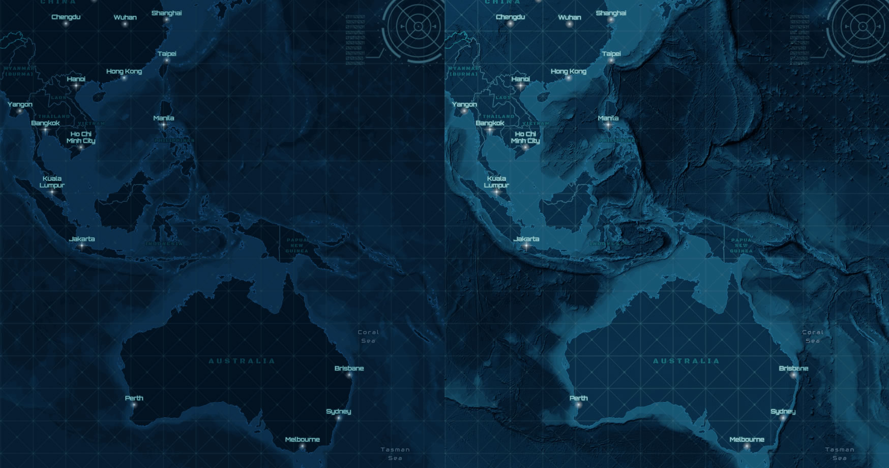
Some examples:
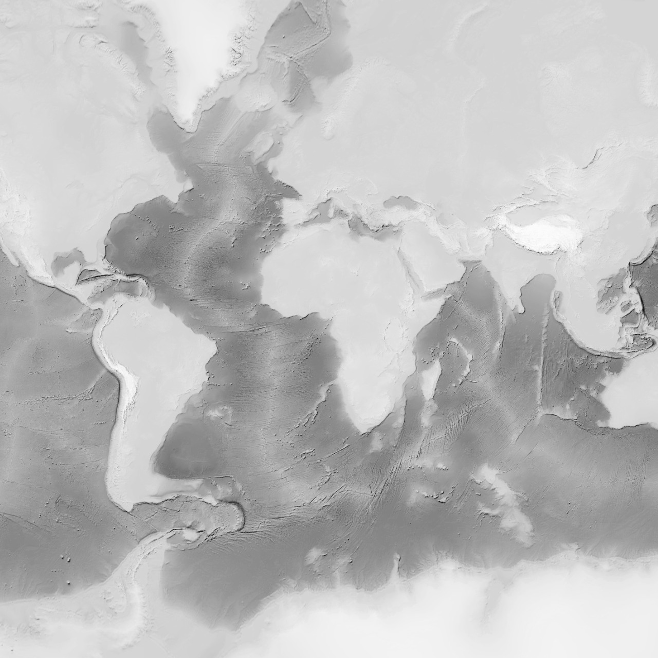
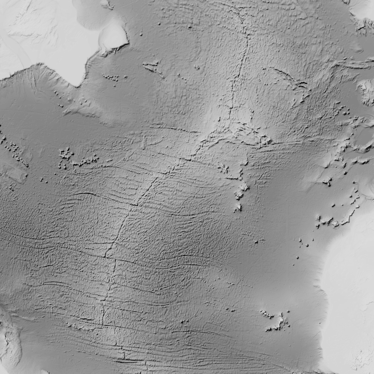
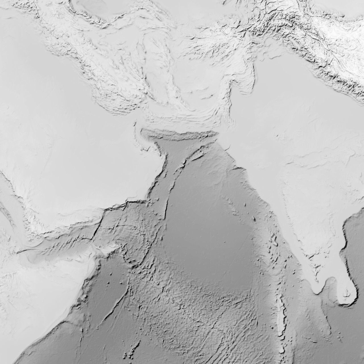
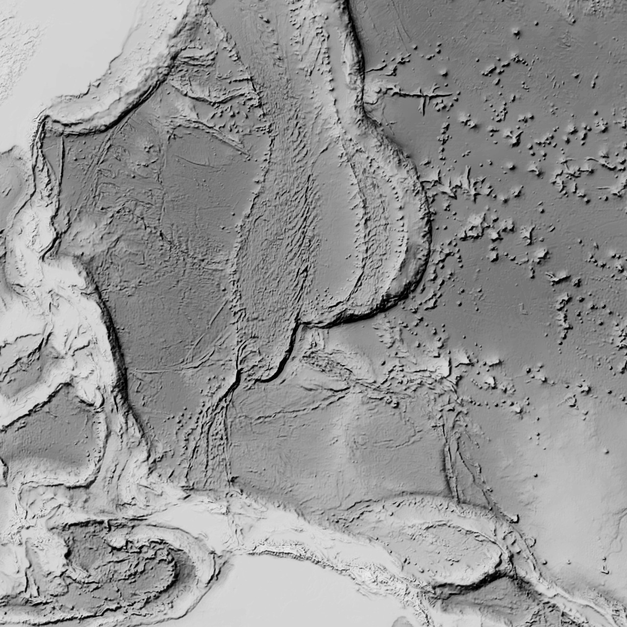
Here are some examples of Generalized Terrain & Bathymetry blended into some basemaps:
Map Name: Layers
Legend
All Layers and Tables
Layers:
- Hillshade on crisp GEBCO(0)
- Hillshade on crisp GEBCO(1)
- Slope on crisp GEBCO(2)
- Slope on 12px blur(3)
- Hillshade_Blur 3 px on GEMBO(4)
- Blur 12 px on GEBCO(5)
- GEBCO(6)
If you'd like a crisp detailed terrain hillshade, consider World Hillshade tiles. Generalized Terrain & Bathymetry works well in addition to that finer-grained World Hillshade.
This tile layer was derived from GEBCO (General Bathymetric Chart of the Oceans) elevations, and processed as hillshade of generalized scales in ArcGIS Pro in a manner similar to what is described in this how-to video: https://youtu.be/-sitCuwXAaE
For a high-resolution compliment suitable at large scales (zoomed in) consider this GEBCO Shaded Relief 2022 tile layer. Find more GEBCO products in Living Atlas.
Some examples:
Here are some examples of Generalized Terrain & Bathymetry blended into some basemaps:
Copyright Text: GEBCO Compilation Group, Esri
Spatial Reference:
102100
Single Fused Map Cache: true
Capabilities: Map,TilesOnly,Tilemap
Tile Info:
- Height: 256
- Width: 256
- DPI: 96
- Levels of Detail: (# Levels: 24)
- Level ID: 0 [Start Tile, End Tile]
- Resolution: 156543.033928
Scale: 5.91657527591555E8 - Level ID: 1 [Start Tile, End Tile]
- Resolution: 78271.5169639999
Scale: 2.95828763795777E8 - Level ID: 2 [Start Tile, End Tile]
- Resolution: 39135.7584820001
Scale: 1.47914381897889E8 - Level ID: 3 [Start Tile, End Tile]
- Resolution: 19567.8792409999
Scale: 7.3957190948944E7 - Level ID: 4 [Start Tile, End Tile]
- Resolution: 9783.93962049996
Scale: 3.6978595474472E7 - Level ID: 5 [Start Tile, End Tile]
- Resolution: 4891.96981024998
Scale: 1.8489297737236E7 - Level ID: 6 [Start Tile, End Tile]
- Resolution: 2445.98490512499
Scale: 9244648.868618 - Level ID: 7 [Start Tile, End Tile]
- Resolution: 1222.99245256249
Scale: 4622324.434309 - Level ID: 8 [Start Tile, End Tile]
- Resolution: 611.49622628138
Scale: 2311162.217155 - Level ID: 9 [Start Tile, End Tile]
- Resolution: 305.748113140558
Scale: 1155581.108577 - Level ID: 10 [Start Tile, End Tile]
- Resolution: 152.874056570411
Scale: 577790.554289 - Level ID: 11 [Start Tile, End Tile]
- Resolution: 76.4370282850732
Scale: 288895.277144 - Level ID: 12 [Start Tile, End Tile]
- Resolution: 38.2185141425366
Scale: 144447.638572 - Level ID: 13 [Start Tile, End Tile]
- Resolution: 19.1092570712683
Scale: 72223.819286 - Level ID: 14 [Start Tile, End Tile]
- Resolution: 9.55462853563415
Scale: 36111.909643 - Level ID: 15 [Start Tile, End Tile]
- Resolution: 4.77731426794937
Scale: 18055.954822 - Level ID: 16 [Start Tile, End Tile]
- Resolution: 2.38865713397468
Scale: 9027.977411 - Level ID: 17 [Start Tile, End Tile]
- Resolution: 1.19432856685505
Scale: 4513.988705 - Level ID: 18 [Start Tile, End Tile]
- Resolution: 0.597164283559817
Scale: 2256.994353 - Level ID: 19 [Start Tile, End Tile]
- Resolution: 0.298582141647617
Scale: 1128.497176 - Level ID: 20 [Start Tile, End Tile]
- Resolution: 0.14929107082380833
Scale: 564.248588 - Level ID: 21 [Start Tile, End Tile]
- Resolution: 0.07464553541190416
Scale: 282.124294 - Level ID: 22 [Start Tile, End Tile]
- Resolution: 0.03732276770595208
Scale: 141.062147 - Level ID: 23 [Start Tile, End Tile]
- Resolution: 0.01866138385297604
Scale: 70.5310735 - Format: MIXED
- Compression Quality: 90
- Origin:
- X: -2.0037508342787E7
Y: 2.0037508342787E7
- Spatial Reference:
102100
- XMin: -8200968.891810925
YMin: -29175.57778205909
XMax: -261301.88977520633
YMax: 4672007.409868172
Spatial Reference:
102100
- XMin: -2.0037507842788246E7
YMin: -3.024097145838615E7
XMax: 2.0037507842788246E7
YMax: 3.024097145838615E7
Spatial Reference:
102100
Max Scale: 0.0
Min LOD: 0
Max LOD: 6
Units: esriMeters
Supported Image Format Types: MIXED
Export Tiles Allowed: true
Max Export Tiles Count: 100000
Resampling: true
Document Info:
- Title: Generalized Terrain & Bathymetry Hillshade
- Author: j_nelson
- Comments:
- Subject: A smoothed terrain hillshade of land and seafloor for broad scales. GEBCO topographic/bathymetric hillshade at zoom levels 0 - 6. Useful for blending general terrain texture to maps at global/regional zoom levels.
- Category:
- Keywords: GEBCO, hillshade, bathymetry, cartography, terrain, DEM, oceans, mountains, shaded relief, tiles, bathy, topo, topographic, topobathy, elevation, digital elevation model